State of the Snowpack – 01/25/2023
After heavy snows followed by scouring East winds, check out our state of the snowpack from Alpenglow Ski Guide Peter Terwilliger.
Right now, the snowpack is ranging from 1 to 3.5 meters deep. About 100 cm down, we have a substantial rain crust from recent storm cycles. On North-facing slopes, the skiing is still very good. Recently, we had gale force upslope winds coming from the N, NE, and E facing slopes. The avalanche danger has moved away from these general areas, however, and the wind slabs are variable and wide-ranging.
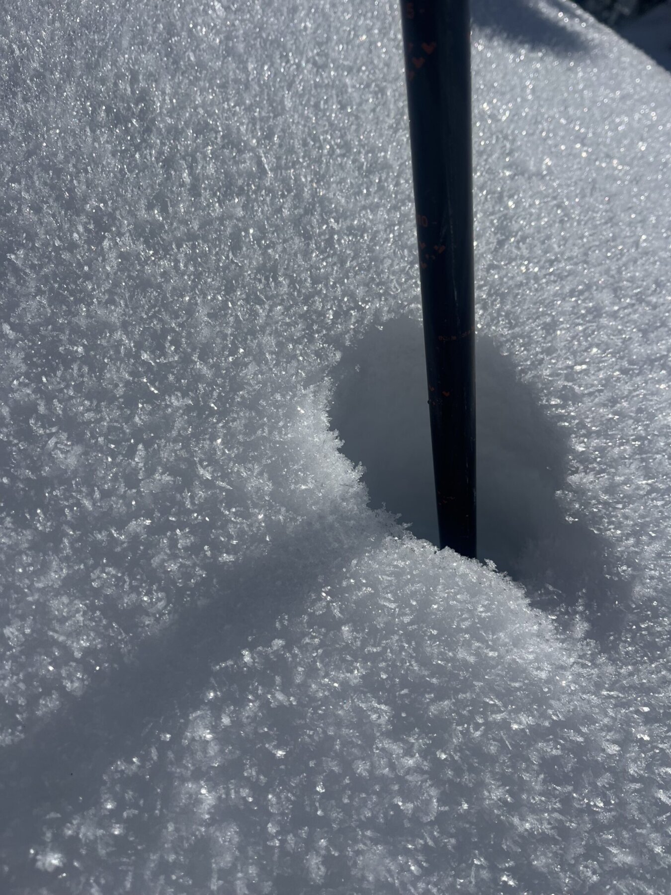
With cold nights, clear skies, and low winds, we’re getting spectacular surface hoar. These conditions are creating what we like to call ‘recycled pow’, where we’re skiing on a facet layer on the surface. If it snows again, we’ll likely be dealing with another persistent weak layer as a result.
The main takeaway is that the skiing is still prime in North-facing, protected areas, mainly in the trees. Be sure to watch out for tree bombs, where the snowmelt from the tree falls and freezes into crust on top of otherwise very soft snow.
Overall, we have a deep snowpack with rain layers down below. It is possible that there’s a deep lurking dragon near the ice layer interfaces, but there are areas with up to 100 cm of skiable snow on top in protected areas that have not been scoured by persistent east winds. ![]()
![]()