Snowpack Update – 11/28/22
Written by Alpenglow Guide and AIARE Instructor Sam Kieckhefer here to provide an update on the state of the snowpack prior to an incoming storm.
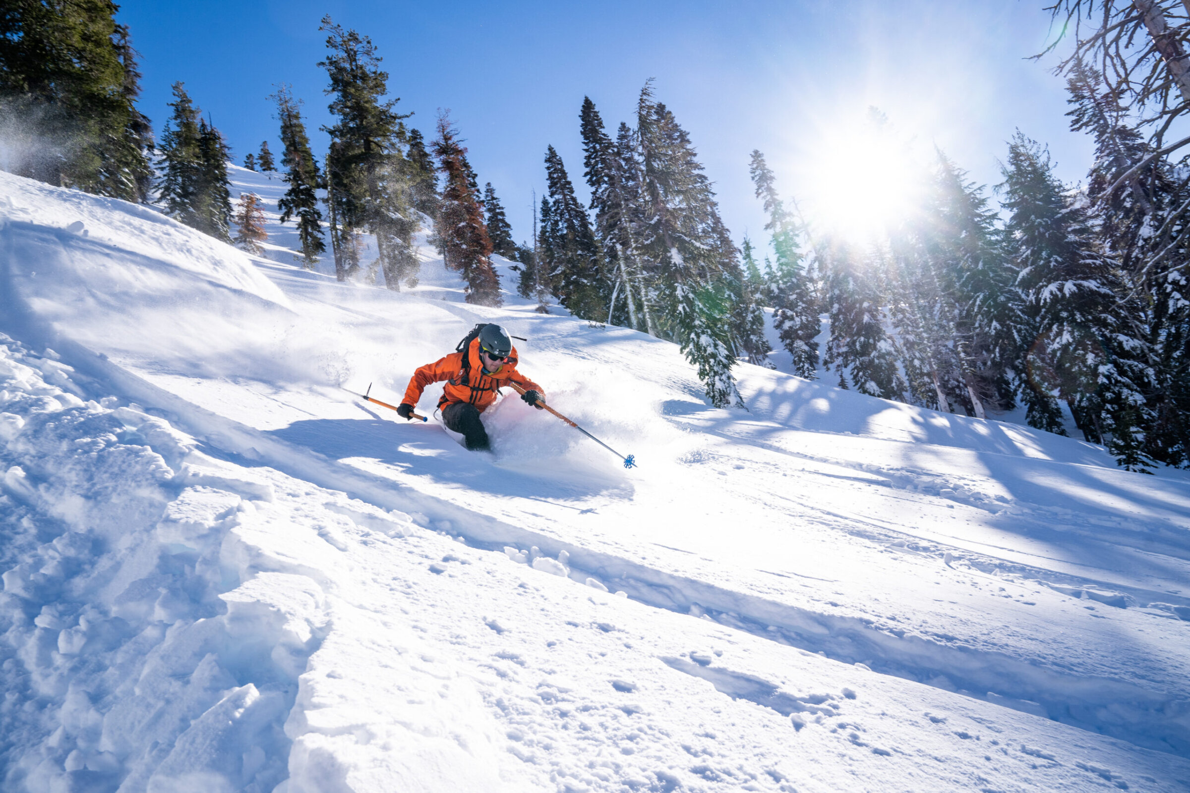
As we close out November and move into December, it’s important to take a look back at the snowpack and evaluate what that means for the winter ahead. If you’re like me, the 30-50” of snow that fell from November 3-9 kick-started the 22/23 ski season and led to some excellent pre-thanksgiving turns. Resorts opened early, and the backcountry skiing around Lake Tahoe was surprisingly good! Hopefully your ratio of quality turns to rocks hit was favorable and all edges remain intact.
 While this early-season surprise was welcome at the time, the two weeks that followed brought relatively cold temperatures and, combined with our shallow snowpack, led to widespread weakening. Before we dive into what that means for the future, know that this is quite common here in the Lake Tahoe area. I honestly can’t think of a recent season that didn’t start with just enough snow to present a problem for some period of time.
So, where does this leave us? As mountain guides, we are trained to constantly evaluate the snowpack, and not only when we’re out in the mountains. Today I’m choosing to get some work done from home before the inbound storm hits later this week, but I’m still thinking about our current snowpack, the incoming storm, and what this will mean for backcountry skiing this weekend and beyond. Here’s my thought process, and while these early season storms have me jonesing to get out skiing, it’s really a better time to catch up on your avalanche education and make sure you’re dialed for what we hope is a long winter to come.
First, remember that weak snow grains are only a problem once they are buried. With an incoming storm beginning Wednesday night that is forecasted to bring up to 5” of snow to the high peaks by Monday morning, we know any and all weak grains are soon to be buried. Fortunately, that doesn’t mean our problem will exist everywhere. Knowing which slopes currently have weak grains, and which slopes do not can help us predict the distribution of future persistent slab avalanche problems. Sometimes those weak grains exist everywhere, sometimes they’re very specific. Regardless, as soon as the snow comes we have to assume they exist everywhere until we have enough data to eliminate certain aspects and elevations from the problem list.
I haven’t been out skiing in the past 10 days or so as I opted to take my first few days as a win and preserve my equipment and body until better coverage exists. Nevertheless, I can gather a lot of data from the road as I drive around town. I know that snow exists on most aspects up high (albeit patchy on solar aspects) and only our south facing aspects are truly bare down low. I also use publicly available wildfire cams to gather information outside of my regular drive pattern and help confirm my assumptions outside the area’s I’ve been able to put eyes on.
With snow existing on most aspects this year, we certainly have the potential for a widespread persistent slab problem once the current weak snowpack is buried. We’ve established the likely aspects (I focus on areas with more than just “patchy” coverage, i.e. West through North through East) that we can expect to find this future problem, it’s helpful to understand how weak the snowpack and how that varies through the forecast region.
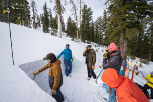
The forecast zone here in Lake Tahoe is quite broad, and conditions often vary throughout the area. While it’s impossible to explore everywhere in the region to track conditions, the Sierra Avalanche Center’s observations page coolates information from forecasters, mountain guides, and members of the public, giving us a peek at conditions throughout the area. Since last Monday the 21st, these Mountain Guides, Forecasters and Professional Observers have submitted snowpack data from the southern part of the region on Carson Pass, up the West Shore on Rubicon, north to Donner Summit and east to Mt Rose. While each snowpit plot shows differences in the snowpack, there’s a common theme; each and every snowpit reported 5+cm of fist-hard faceted snow on or near the surface. Some of these pits are showing that the top 20cm of the snowpack consists of fist hard facets. Yikes!
How will the new snow bond to the weak, faceted base that we have? We’ll have to wait for the new snow to really find out, but I can tell you I’ll be exploring with extreme caution as this storm moves through. Our snowpack will be quite complicated to kick off December, and it’s important to keep enthusiasm in check. If you’re pursuing Avalanche Education this December, you’ll certainly get your money’s worth as there will be a lot to look at, feel and talk about! Consider hiring a mountain guide as these problem layers sort themselves out.